BGS Data Catalogue
Engineering Properties:Discontinuities
This dataset is a characterisation of discontinuity types found within rocks and soils in Great Britain. Discontinuities are breaks, fractures or planes of weakness in the rock mass. The dataset includes type, frequency and orientation of discontinuities within rock and soil materials at formation (local to regional) scale. The discontinuities are classified in 3 categories: stratification (bedding planes), foliation (mineral banding) and rock mass description. The dataset aims to facilitate the preliminary research for planning and design of buildings, infrastructure and resource extraction. It forms part of the DiGMap Plus dataset series of GIS layers which describes the engineering properties of materials from the base of pedological soil down to c. 3m depth (ie the uppermost c.2m of geology). These deposits display a variable degree of weathering, but still exhibit core engineering characteristics relating to their lithologies.
INSPIRE
Identification
- File identifier
- 24e52c19-45f8-6a69-e054-002128a47908 XML
- Resource type
- dataset
Online resource
- Protocol
-
HTTP
Resource identifier
- Metadata Language
- English (en)
- Spatial representation type
- vector
Encoding
- Format
-
Shapefile
Projection
Classification of data and services
- Topic category
-
- Geoscientific information
Classification of data and services
Coupled resource
Coupled resource
Classification of data and services
Coupled resource
Coupled resource
Keywords
- GEMET - INSPIRE themes, version 1.0
- BGS Thesaurus of Geosciences
-
-
Engineering
-
UK Location (INSPIRE)
-
Engineering geology
-
Geology
-
Geological structures
-
Discontinuity
-
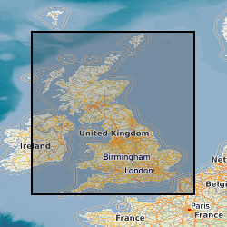
Geographic coverage
))
Temporal reference
Temporal extent
Temporal extent
- Dataset Reference Date ()
- 2015-06-03
Quality and validity
- Lineage
-
The source data for this dataset is based on the digital geological map of GB (DiGMapGB-50) which has been processed to create the Parent Material Map (PMM) V6 at 50K scale. This provided the underlying geology areas (polygons). The geology has been reattributed using a set of engineering properties. Data was collated and interpreted from a number of different sources held by BGS including BGS National Geotechnical Properties Database BGS Lexicon of Named Rock Units BGS Map Sheet Explanations BGS Sheet Memoirs BGS Geoscience Imagebase BGS and Geological Society Regional Guides BGS Urban Planning Reports BGS Engineering Geology Formation Study Reports Site Investigation Records and Borehole Scans held in BGS archives These data were used to devise engineering property values by BGS experts and applied to the PMM data using a series of lookup tables to describe the uppermost 2m in relation to its discontinuity properties. The DiGMapPlus datasets follow a standard workflow to create each dataset: - Step 1: Identify characteristic, measurements and observations from archive records. - Step 2: Categorise the observations into classes/groups of similar behaviours. Where possible using published standards of classification such as BS 5930, Eurocode 7 or other similar international or national standard. - Step 3: Assess the range of lithstratigraphic variation of geological materials across Great Britain, in terms of the categories and classes identified in step 2 to create a 'lookup' dataset of expected attributes (material characteristics and behaviours) per lithostratigraphic unit. - Step 4: Compile the spatial (map) components of the DiGMapPlus datasets with the 'lookup' dataset using standard GIS and data techniques to create a new 'map' of discontinuity characteristics. Spatial data-creation and discontinuity attribution has been completed using ESRI ARCGIS software.
- Denominator
- 50000
Conformity
Conformity
Conformity
Conformity
Conformity
Conformity
- Explanation
-
See the referenced specification
Restrictions on access and use
- Access constraints
- license
- Access constraints
-
The copyright of materials derived from the British Geological Survey's work is vested in the Natural Environment Research Council [NERC]. No part of this work may be reproduced or transmitted in any form or by any means, or stored in a retrieval system of any nature, without the prior permission of the copyright holder, via the BGS Intellectual Property Rights Manager. Use by customers of information provided by the BGS, is at the customer's own risk. In view of the disparate sources of information at BGS's disposal, including such material donated to BGS, that BGS accepts in good faith as being accurate, the Natural Environment Research Council (NERC) gives no warranty, expressed or implied, as to the quality or accuracy of the information supplied, or to the information's suitability for any use. NERC/BGS accepts no liability whatever in respect of loss, damage, injury or other occurence however caused.
- Access constraints
-
Either: (i) the dataset is made freely available, e.g. via the Internet, for a restricted category of use (e.g. educational use only); or (ii) the dataset has not been formally approved by BGS for access and use by external clients under licence, but its use may be permitted under alternative formal arrangements; or (iii) the dataset contains 3rd party data or information obtained by BGS under terms and conditions that must be consulted in order to determine the permitted usage of the dataset. Refer to the BGS staff member responsible for the creation of the dataset if further advice is required. He / she should be familiar with the composition of the dataset, particularly with regard to 3rd party IPR contained in it, and any resultant use restrictions. This staff member should revert to the IPR Section (ipr@bgs.ac.uk) for advice, should the position not be clear. ipr@bgs.ac Either: (i) the dataset is made freely available, e.g. via the Internet, for a restricted category of use (e.g. educational use only); or (ii) the dataset has not been formally approved by BGS for access and use by external clients under licence, but its use may be permitted under alternative formal arrangements; or (iii) the dataset contains 3rd party data or information obtained by BGS under terms and conditions that must be consulted in order to determine the permitted usage of the dataset. Refer to the BGS staff member responsible for the creation of the dataset if further advice is required. He / she should be familiar with the composition of the dataset, particularly with regard to 3rd party IPR contained in it, and any resultant use restrictions. This staff member should revert to the IPR Section (ipr@bgs.ac.uk) for advice, should the position not be clear.
Responsible organization (s)
Contact for the resource
- Organisation name
-
British Geological Survey
-
enquiries@bgs.ac enquiries@bgs.ac.uk
- Organisation name
-
British Geological Survey
-
enquiries@bgs.ac enquiries@bgs.ac.uk
Responsible organization (s)
Contact for the resource
- Organisation name
-
British Geological Survey
-
enquiries@bgs.ac enquiries@bgs.ac.uk
- Organisation name
-
British Geological Survey
-
enquiries@bgs.ac enquiries@bgs.ac.uk
Metadata information
Contact for the metadata
- Organisation name
-
British Geological Survey
-
enquiries@bgs.ac enquiries@bgs.ac.uk
- Metadata Date
- 2024-04-25
- Metadata Language
- English (en)