 BGS Metadata Catalogue
EU project data: SACS / SACS2 data - Final Regional Digital Grids of the Utsira Sand (1999 - 2002)
Regional property grids of the Utsira Sand based on mapping from 2D regional seismic lines and geophysical logs. Grids include: Top Utsira depth, Base Utsira depth, Utsira isopach, Utsira porosity, Utsira porosity effective thickness, Utsira proportion clean sand. 2 km grid spacing. SACS/SACS2 EU project.
Simple
- Date (Creation)
- 2002-04-30
- Citation identifier
- http://data.bgs.ac.uk/id/dataHolding/13606842
- Point of contact
-
Organisation name Individual name Electronic mail address Role British Geological Survey
Enquiries
Distributor British Geological Survey
Enquiries
Point of contact
- Maintenance and update frequency
- notApplicable
-
GEMET - INSPIRE themes, version 1.0
-
BGS Thesaurus of Geosciences
-
-
Carbon capture and storage
-
- dataCentre
- Keywords
-
-
NERC_DDC
-
- Access constraints
- Other restrictions
- Other constraints
- no limitations
- Other constraints
- The dataset is made freely available for access, e.g. via the Internet. Either no third party data / information is contained in the dataset or BGS has secured written permission from the owner(s) of any third party data / information contained in the dataset to make the dataset freely accessible.
- Use constraints
- Other restrictions
- Other constraints
-
The copyright of materials derived from the British Geological Survey's work is vested in the Natural Environment Research Council [NERC]. No part of this work may be reproduced or transmitted in any form or by any means, or stored in a retrieval system of any nature, without the prior permission of the copyright holder, via the BGS Intellectual Property Rights Manager. Use by customers of information provided by the BGS, is at the customer's own risk. In view of the disparate sources of information at BGS's disposal, including such material donated to BGS, that BGS accepts in good faith as being accurate, the Natural Environment Research Council (NERC) gives no warranty, expressed or implied, as to the quality or accuracy of the information supplied, or to the information's suitability for any use. NERC/BGS accepts no liability whatever in respect of loss, damage, injury or other occurence however caused.
- Other constraints
-
There are no restrictions on the use that may be made of the dataset, although an appropriate copyright acknowledgement must be made when any part of the dataset is reproduced. Either no third party data / information is contained in the dataset or BGS has secured written permission from the owner of any third party data / information contained in the dataset to make the dataset freely available without any use constraints - inclusion of any third party data / information will affect the copyright acknowledgement that needs to be made.
- Language
- English
- Topic category
-
- Geoscientific information
- Geographic identifier
-
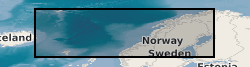
NORWEGIAN SEA [id=2001384]
British Geological Survey Gazetteer: Gazetteer of sea areas 2010 revision
))
- Begin date
- 1999-01-01
- End date
- 2002-04-30
- Unique resource identifier
- WGS 84 / UTM zone 31N (EPSG::32631)
- Distribution format
-
Name Version Microsoft Excel (XLS)
- Distributor contact
-
Organisation name Individual name Electronic mail address Role British Geological Survey
Enquiries
Distributor
- OnLine resource
-
Protocol Linkage Name WWW:DOWNLOAD-1.0-http--download
https://ukccs-research.org/accessions/index.html#item42369
- Hierarchy level
- Dataset
- Other
-
dataset
Conformance result
- Title
-
INSPIRE Implementing rules laying down technical arrangements for the interoperability and harmonisation of Geology
- Date (Publication)
- 2011
- Explanation
-
See the referenced specification
- Pass
- No
Conformance result
- Title
-
Commission Regulation (EU) No 1089/2010 of 23 November 2010 implementing Directive 2007/2/EC of the European Parliament and of the Council as regards interoperability of spatial data sets and services
- Date (Publication)
- 2010-12-08
- Explanation
-
See http://eur-lex.europa.eu/LexUriServ/LexUriServ.do?uri=OJ:L:2010:323:0011:0102:EN:PDF
- Pass
- No
- Statement
-
Source data comprise a regional grid of 2D seismic lines and a large number of geophysical well logs. Top and Base Utsira Sand were mapped in two-way travel-time from the data and from this regional scale grids were generated of top and base sand and sand isochore. Key reservoir properties were derived from the geophysical well logs, gridded and integrated with the travel-time and isochore data to produce depth, isopach and property grids.
Metadata
- File identifier
- 21e7b5a6-386c-5a1e-e054-002128a47908 XML
- Metadata language
- English
- Hierarchy level
- Dataset
- Date stamp
- 2026-07-11
- Metadata standard name
- UK GEMINI
- Metadata standard version
-
2.3
- Metadata author
-
Organisation name Individual name Electronic mail address Role British Geological Survey
Point of contact
- Dataset URI
)))
