 BGS Metadata Catalogue
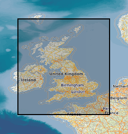
Quaternary deposits summary lithologies across the UK Continental Shelf (2014 Version)
The Quaternary deposits summary lithologies dataset is a digital geological map across the bulk of the UK Continental Shelf (UKCS), for areas up to a water depth of 200 m, which groups the deposits into classes based on similar engineering geology characteristics. The map is derived from (unpublished) BGS 1:1,000,000 scale Quaternary digital geological mapping, so is effective at that scale. The map was produced in 2014 in collaboration with, and co-funded by, The Crown Estate as part of a wider commissioned project to assess seabed geological constraints on engineering infrastructure across the UKCS. The divisions on the map combine the Quaternary deposits into 7 categories of similar strength and lithological variability, each with a ‘Category’ title that summarises their main lithological character: diamict; firm to hard interbedded (layered); firm to hard mud; sand and gravel; soft interbedded; soft mud; undifferentiated. These categories can be used as a basis for assessing, in conjunction with a range of other geological factors, the geological constraints on engineering structures at or close to the seabed. The data are held by the BGS as an ESRI ArcGIS Shapefile.
Simple
- Date (Creation)
- 2014-03-31
- Citation identifier
- http://data.bgs.ac.uk/id/dataHolding/13606630
- Point of contact
-
Organisation name Individual name Electronic mail address Role British Geological Survey
Enquiries
Distributor British Geological Survey
Enquiries
Point of contact
- Maintenance and update frequency
- Not planned
-
GEMET - INSPIRE themes, version 1.0
-
BGS Thesaurus of Geosciences
-
-
Continental shelf
-
Marine geology
-
Lithology
-
Engineering geology
-
- dataCentre
- Keywords
-
-
NERC_DDC
-
- Access constraints
- Other restrictions
- Other constraints
- no limitations
- Other constraints
- The dataset is made freely available for access, e.g. via the Internet. Either no third party data / information is contained in the dataset or BGS has secured written permission from the owner(s) of any third party data / information contained in the dataset to make the dataset freely accessible.
- Use constraints
- Other restrictions
- Other constraints
-
The copyright of materials derived from the British Geological Survey's work is vested in the Natural Environment Research Council [NERC]. No part of this work may be reproduced or transmitted in any form or by any means, or stored in a retrieval system of any nature, without the prior permission of the copyright holder, via the BGS Intellectual Property Rights Manager. Use by customers of information provided by the BGS, is at the customer's own risk. In view of the disparate sources of information at BGS's disposal, including such material donated to BGS, that BGS accepts in good faith as being accurate, the Natural Environment Research Council (NERC) gives no warranty, expressed or implied, as to the quality or accuracy of the information supplied, or to the information's suitability for any use. NERC/BGS accepts no liability whatever in respect of loss, damage, injury or other occurence however caused.
- Other constraints
-
Available under the Open Government Licence subject to the following acknowledgement accompanying the reproduced NERC materials "Contains NERC materials ©NERC [year]"
- Spatial representation type
- Vector
- Denominator
- 250000
- Language
- English
- Topic category
-
- Geoscientific information
- Geographic identifier
-
UK CONTINENTAL SHELF [id=121701]
British Geological Survey Gazetteer: Geographical hierarchy from Geosaurus 1979 creation
))
- Begin date
- 1966
- End date
- 2013
- Unique resource identifier
- WGS 84 (EPSG::4326)
- Distribution format
-
Name Version ESRI Shapefile
1994
- Distributor contact
-
Organisation name Individual name Electronic mail address Role British Geological Survey
Enquiries
Distributor
- OnLine resource
-
Protocol Linkage Name WWW:LINK-1.0-http--related
https://doi.org/10.5285/a9832e62-4054-42ba-9251-bf48dd363ef6 Citation Information - Digital Object Identifier (DOI)
- OnLine resource
-
Protocol Linkage Name WWW:DOWNLOAD-1.0-http--download
https://webapps.bgs.ac.uk/services/ngdc/accessions/index.html#item172371 DATA - Quaternary deposits summary lithologies across the UK Continental Shelf (2014 Version)
- Hierarchy level
- Dataset
- Other
-
dataset
Conformance result
- Title
-
INSPIRE Implementing rules laying down technical arrangements for the interoperability and harmonisation of Geology
- Date (Publication)
- 2011
- Explanation
-
See the referenced specification
- Pass
- No
Conformance result
- Title
-
Commission Regulation (EU) No 1089/2010 of 23 November 2010 implementing Directive 2007/2/EC of the European Parliament and of the Council as regards interoperability of spatial data sets and services
- Date (Publication)
- 2010-12-08
- Explanation
-
See http://eur-lex.europa.eu/LexUriServ/LexUriServ.do?uri=OJ:L:2010:323:0011:0102:EN:PDF
- Pass
- No
- Statement
-
Lithostratigraphic units defined in the BGS 1:1000000 Quaternary Geology map were assessed in terms of strength and lithological variability. Lithostratigraphic units were then grouped into classess depending on their expected impact on engineering activities. The resulting classes were attributed in GIS to shapefiles defined by BGS Lexicon Codes (Lithostratigraphic units). Part of this dataset, mainly around the coastline, has been coarsely interpolated so that its extent covers the whole factor map area. The methodology used to fill in no-data areas consists of dividing these areas into square grids (10 x 10 km) where each polygon within the grid will get assigned the category value of the polygon sharing its border in an iterative process until all polygons within the grid have a category value. This iteration was done by running the ArcGIS Spatial Join tool several times with the match option “SHARE_A_LINE_SEGMENT_WITH”. The final step is merging the now attributed grid to the dataset and dissolving the polygons.
Metadata
- File identifier
- 166c7ca4-0bfe-1f2d-e054-002128a47908 XML
- Metadata language
- English
- Hierarchy level
- Dataset
- Date stamp
- 2026-07-26
- Metadata standard name
- UK GEMINI
- Metadata standard version
-
2.3
- Metadata author
-
Organisation name Individual name Electronic mail address Role British Geological Survey
Point of contact
- Dataset URI
)))
