 BGS Metadata Catalogue
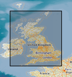
BGS Geology - 10k (DiGMapGB-10) Superficial version 2
Data identifying landscape areas (shown as polygons) attributed with geological names and rock type descriptions. The scale of the data is 1:10 000 scale. Onshore coverage is partial with approximately 30% of England, Scotland and Wales available in the version 2 data release. BGS intend to continue developing coverage at this scale; current focus is to include all large priority urban areas, along with road and rail transport corridors. Superficial deposits are the youngest geological deposits formed during the most recent period of geological time, the Quaternary, which extends back about 2.58 million years from the present. They lie on top of older deposits or rocks referred to as bedrock. Superficial deposits were laid down by various natural processes such as action by ice, water, wind and weathering. As such, the deposits are denoted by their BGS lexicon name, which classifies them on the basis of mode of origin (lithogenesis) with names such as, 'glacial deposits', 'river terrace deposits' or 'blown sand'; or on the basis of their composition such as 'peat'. Most of these superficial deposits are unconsolidated sediments such as gravel, sand, silt and clay. The digital data includes attribution to identify each deposit type (in varying levels of detail) as described in the BGS Rock Classification Scheme (volume 4). The data are available in vector format (containing the geometry of each feature linked to a database record describing their attributes) as ESRI shapefiles and are available under BGS data licence.
Simple
- Date (Creation)
- 2011
- Citation identifier
- http://data.bgs.ac.uk/id/dataHolding/13606391
- Point of contact
-
Organisation name Individual name Electronic mail address Role British Geological Survey
Enquiries
Distributor British Geological Survey
Enquiries
Point of contact
- Maintenance and update frequency
- Not planned
-
GEMET - INSPIRE themes, version 1.0
-
BGS Thesaurus of Geosciences
-
-
Maps
-
GIS
-
Geology
-
Data
-
Digital maps
-
- dataCentre
- Keywords
-
-
NERC_DDC
-
- Access constraints
- Other restrictions
- Other constraints
- license
- Use constraints
- Other restrictions
- Other constraints
-
The copyright of materials derived from the British Geological Survey's work is vested in the Natural Environment Research Council [NERC]. No part of this work may be reproduced or transmitted in any form or by any means, or stored in a retrieval system of any nature, without the prior permission of the copyright holder, via the BGS Intellectual Property Rights Manager. Use by customers of information provided by the BGS, is at the customer's own risk. In view of the disparate sources of information at BGS's disposal, including such material donated to BGS, that BGS accepts in good faith as being accurate, the Natural Environment Research Council (NERC) gives no warranty, expressed or implied, as to the quality or accuracy of the information supplied, or to the information's suitability for any use. NERC/BGS accepts no liability whatever in respect of loss, damage, injury or other occurence however caused.
- Other constraints
-
The dataset is made available to external clients under BGS Digital Data Licence terms and conditions. Revert to the IPR Section ( iprdigital@bgs.ac.uk) if further advice is required with regard to permitted usage.
- Spatial representation type
- Vector
- Denominator
- 250000
- Language
- English
- Topic category
-
- Geoscientific information
- Geographic identifier
-
GBN
ISO 3166_2 2009 revision
- Geographic identifier
-
GREAT BRITAIN [id=139600]
British Geological Survey Gazetteer: Geographical hierarchy from Geosaurus 1979 creation
))
- End date
- 2011
- Unique resource identifier
- OSGB 1936 / British National Grid (EPSG::27700)
- Distribution format
-
Name Version ESRI Shapefile
1994
- Distributor contact
-
Organisation name Individual name Electronic mail address Role British Geological Survey
Enquiries
Distributor
- OnLine resource
-
Protocol Linkage Name WWW:LINK-1.0-http--related
https://doi.org/10.5285/c32d881e-180c-41f4-92c9-6aaf7044c66a Citation Information - Digital Object Identifier (DOI)
- Hierarchy level
- Dataset
- Other
-
dataset
Conformance result
- Title
-
INSPIRE Implementing rules laying down technical arrangements for the interoperability and harmonisation of Geology
- Date (Publication)
- 2011
- Explanation
-
See the referenced specification
- Pass
- No
Conformance result
- Title
-
Commission Regulation (EU) No 1089/2010 of 23 November 2010 implementing Directive 2007/2/EC of the European Parliament and of the Council as regards interoperability of spatial data sets and services
- Date (Publication)
- 2010-12-08
- Explanation
-
See http://eur-lex.europa.eu/LexUriServ/LexUriServ.do?uri=OJ:L:2010:323:0011:0102:EN:PDF
- Pass
- No
- Statement
-
The BGS Geology 10k dataset is a digital representation of the geology of Great Britain at 1: 10 000 scale. It is a compilation of digital tiles derived from previously published and unpublished maps, archive information and results of field mapping campaigns. The mapping, description and classification of rocks are based upon the interpretations and evidence available at the time of survey, or time of re-evaluation for modifications/correction. The data has been digitally captured from paper record, originally using Bentley MicroStation and latterly ESRI ArcGIS software. Post capture processing has occurred to combine geometry and attribution from existing BGS data resources. Quality control checks are run on individual data batches prior and subsequent to their integration into the main data mosaic. The source dataset is dynamic in nature with periodic comprehensive data releases.
Metadata
- File identifier
- 085bd761-7435-3315-e054-002128a47908 XML
- Metadata language
- English
- Hierarchy level
- Dataset
- Date stamp
- 2026-07-28
- Metadata standard name
- UK GEMINI
- Metadata standard version
-
2.3
- Metadata author
-
Organisation name Individual name Electronic mail address Role British Geological Survey
Point of contact
- Dataset URI
)))
