 BGS Metadata Catalogue
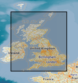
BGS Geology 250k Linear version 4
Data identifying linear features representing geological faults at the ground or bedrock surface (beneath superficial deposits). The scale of the data is 1:250 000, providing a generalised set of linear features. Onshore coverage is provided for all of England, Wales, Scotland, and the Isle of Man. Geological faults occur where a body of bedrock has been fractured and displaced by large scale processes affecting the Earth's crust (tectonic forces). The digital data are attributed by fault type; two categories of fault are described in the data: contact and non-contact faults. Contact faults form a boundary between two different rock types whilst non-contact faults indicate a fault displacement within the same rock. The data have been generalised and show only the location of major faults. All faults shown are inferred (i.e. not exposed or seen at a locality), but derived from other evidence including linear depressions in the landscape, the truncation or displacement of topographical features. The data are available in vector format (containing the geometry of each feature linked to a database record describing their attributes) as ESRI Shapefiles and are available under BGS data licence.
Simple
- Date (Creation)
- 2005
- Citation identifier
- http://data.bgs.ac.uk/id/dataHolding/13606376
- Point of contact
-
Organisation name Individual name Electronic mail address Role British Geological Survey
Enquiries
Distributor British Geological Survey
Enquiries
Point of contact
- Maintenance and update frequency
- Not planned
-
GEMET - INSPIRE themes, version 1.0
-
BGS Thesaurus of Geosciences
-
-
Maps
-
Data
-
Faults
-
Bed rock
-
Digital maps
-
Geology
-
GIS
-
- dataCentre
- Keywords
-
-
NERC_DDC
-
- Access constraints
- Other restrictions
- Other constraints
- no limitations
- Other constraints
- The dataset is made freely available for access, e.g. via the Internet. Either no third party data / information is contained in the dataset or BGS has secured written permission from the owner(s) of any third party data / information contained in the dataset to make the dataset freely accessible.
- Use constraints
- Other restrictions
- Other constraints
-
The copyright of materials derived from the British Geological Survey's work is vested in the Natural Environment Research Council [NERC]. No part of this work may be reproduced or transmitted in any form or by any means, or stored in a retrieval system of any nature, without the prior permission of the copyright holder, via the BGS Intellectual Property Rights Manager. Use by customers of information provided by the BGS, is at the customer's own risk. In view of the disparate sources of information at BGS's disposal, including such material donated to BGS, that BGS accepts in good faith as being accurate, the Natural Environment Research Council (NERC) gives no warranty, expressed or implied, as to the quality or accuracy of the information supplied, or to the information's suitability for any use. NERC/BGS accepts no liability whatever in respect of loss, damage, injury or other occurence however caused.
- Other constraints
-
The dataset is made available to external clients under BGS Digital Data Licence terms and conditions. Revert to the IPR Section ( iprdigital@bgs.ac.uk) if further advice is required with regard to permitted usage.
- Spatial representation type
- Vector
- Denominator
- 250000
- Language
- English
- Topic category
-
- Geoscientific information
- Geographic identifier
-
GBN
ISO 3166_2 2009 revision
- Geographic identifier
-
GREAT BRITAIN [id=139600]
British Geological Survey Gazetteer: Geographical hierarchy from Geosaurus 1979 creation
))
- End date
- 2005 Before
- Unique resource identifier
- OSGB 1936 / British National Grid (EPSG::27700)
- Distribution format
-
Name Version ESRI Shapefile
1994
- Distributor contact
-
Organisation name Individual name Electronic mail address Role British Geological Survey
Enquiries
Distributor
- OnLine resource
-
Protocol Linkage Name WWW:LINK-1.0-http--related
https://doi.org/10.5285/583cfc0a-8619-4002-bfb6-a105bad16a4c Citation Information - Digital Object Identifier (DOI)
- OnLine resource
-
Protocol Linkage Name WWW:LINK-1.0-http--link
https://www.bgs.ac.uk/datasets/bgs-geology/ BGS Geology: onshore digital geological map of Great Britain data
- OnLine resource
-
Protocol Linkage Name WWW:LINK-1.0-http--link
https://www.bgs.ac.uk/datasets/bgs-geology-250k/ BGS Datasets - BGS Geology 250K
- Hierarchy level
- Dataset
- Other
-
dataset
Conformance result
- Title
-
INSPIRE Implementing rules laying down technical arrangements for the interoperability and harmonisation of Geology
- Date (Publication)
- 2011
- Explanation
-
See the referenced specification
- Pass
- No
Conformance result
- Title
-
Commission Regulation (EU) No 1089/2010 of 23 November 2010 implementing Directive 2007/2/EC of the European Parliament and of the Council as regards interoperability of spatial data sets and services
- Date (Publication)
- 2010-12-08
- Explanation
-
See http://eur-lex.europa.eu/LexUriServ/LexUriServ.do?uri=OJ:L:2010:323:0011:0102:EN:PDF
- Pass
- No
- Statement
-
Each 100 x 100 km digital tile is based on the latest BGS 1:250 000 scale UTM (Universal Transverse Mercator projection) bedrock or ‘solid’ geological map. This series was originally published between 1977 and 1993. Most of the onshore areas were compiled in the 1980s and are based, primarily, on earlier more detailed 1:50 000 (and one-inch to one-mile) geological maps published in the preceding decades and dating from the 1870s through to the 1980s. The source 1:250 000 published maps have a chronostratigraphical classification but were reclassified, as far as possible, with a lithostratigraphical nomenclature for the digital data. Some changes were made to the published lines to correct errors, improve the fit between maps, add formational boundaries or remove purely chronostratigraphical ones. The sources of information specific to each digital tile are available. The generalised geological lines were fitted to topographical bases compiled from Ordnance Survey 1:250 000 maps and Ministry of Defence, Joint Operations Graphic (JOG) sheets. The UTM series sheets were scanned and re-projected to OS British National Grid for digitising. For version 4 (release 2005), the digital data were re-tiled into 100 km squares and re-fitted to the OS Strategi coastline, and RCS (BGS Rock Classificiation Scheme) codes were added.
Metadata
- File identifier
- 0600d0f5-2bcb-5428-e054-002128a47908 XML
- Metadata language
- English
- Hierarchy level
- Dataset
- Date stamp
- 2026-07-10
- Metadata standard name
- UK GEMINI
- Metadata standard version
-
2.3
- Metadata author
-
Organisation name Individual name Electronic mail address Role British Geological Survey
Point of contact
- Dataset URI
)))
