 BGS Metadata Catalogue
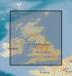
BGS Geology - 625k (DiGMapGB-625) Linear (Faults) version 5
Data identifying linear features (shown as polylines) representing geological faults at the ground or bedrock surface (beneath superficial deposits). The scale of the data is 1:625 000 scale, providing a simplified interpretation of the linear features which may be used as a guide at a regional or national level, but should not be relied on for local geology. Onshore coverage is provided for all of England, Wales, Scotland, the Isle of Man and Northern Ireland. Geological faults occur where a body of bedrock has been fractured and displaced by large scale processes affecting the Earth's crust (tectonic forces). The digital data are attributed by fault type; two categories of fault are described in the data: fault at rockhead (representing normal dip-slip and strike-slip faults) and thrust fault (representing faults caused by compressive forces). The data have been generalised and show only the locations of major faults. The data are available in vector format (containing the geometry of each feature linked to a database record describing their attributes) as an OGC GeoPackage and are delivered free of charge under the terms of the Open Government Licence.
Simple
- Date (Publication)
- 2008
- Citation identifier
- http://data.bgs.ac.uk/id/dataHolding/13606338
- Point of contact
-
Organisation name Individual name Electronic mail address Role British Geological Survey
Enquiries
Distributor British Geological Survey
Enquiries
Originator British Geological Survey
Enquiries
Point of contact
- Maintenance and update frequency
- Irregular
-
GEMET - INSPIRE themes, version 1.0
-
BGS Thesaurus of Geosciences
-
-
Geology
-
Maps
-
Data
-
Digital maps
-
GIS
-
- dataCentre
- Keywords
-
-
NERC_DDC
-
- Access constraints
- Other restrictions
- Other constraints
- no limitations
- Other constraints
- The dataset is made freely available for access, e.g. via the Internet. Either no third party data / information is contained in the dataset or BGS has secured written permission from the owner(s) of any third party data / information contained in the dataset to make the dataset freely accessible.
- Use constraints
- Other restrictions
- Other constraints
-
The copyright of materials derived from the British Geological Survey's work is vested in the Natural Environment Research Council [NERC]. No part of this work may be reproduced or transmitted in any form or by any means, or stored in a retrieval system of any nature, without the prior permission of the copyright holder, via the BGS Intellectual Property Rights Manager. Use by customers of information provided by the BGS, is at the customer's own risk. In view of the disparate sources of information at BGS's disposal, including such material donated to BGS, that BGS accepts in good faith as being accurate, the Natural Environment Research Council (NERC) gives no warranty, expressed or implied, as to the quality or accuracy of the information supplied, or to the information's suitability for any use. NERC/BGS accepts no liability whatever in respect of loss, damage, injury or other occurence however caused.
- Other constraints
-
Available under the Open Government Licence subject to the following acknowledgement accompanying the reproduced NERC materials "Contains NERC materials ©NERC [year]"
- Spatial representation type
- Vector
- Denominator
- 625000
- Language
- English
- Topic category
-
- Geoscientific information
- Geographic identifier
-
GB
ISO 3166_1 alpha-3 2009 revision
- Geographic identifier
-
UK [id=139300]
British Geological Survey Gazetteer: Geographical hierarchy from Geosaurus 1979 creation
- Geographic identifier
-
UKM
ISO 3166_2 2009 revision
))
- End date
- 2008
- Unique resource identifier
- OSGB 1936 / British National Grid (EPSG::27700)
- Unique resource identifier
- WGS 84 (EPSG::4326)
- Distribution format
-
Name Version OGC GeoPackage (GPKG)
ESRI Shapefile
1994
- Distributor contact
-
Organisation name Individual name Electronic mail address Role British Geological Survey
Enquiries
Distributor
- OnLine resource
-
Protocol Linkage Name WWW:DOWNLOAD-1.0-http--download
https://www.bgs.ac.uk/datasets/bgs-geology-625k/ BGS Geology 625K
- OnLine resource
-
Protocol Linkage Name WWW:LINK-1.0-http--related
https://doi.org/10.5285/170bae4c-dd20-4899-96be-299880e7f972 Citation Information - Digital Object Identifier (DOI)
- OnLine resource
-
Protocol Linkage Name WWW:LINK-1.0-http--link
https://www.bgs.ac.uk/datasets/bgs-geology/ BGS Geology: onshore digital geological map of Great Britain data
- Hierarchy level
- Dataset
- Other
-
dataset
Conformance result
- Title
-
INSPIRE Implementing rules laying down technical arrangements for the interoperability and harmonisation of Geology
- Date (Publication)
- 2011
- Explanation
-
See the referenced specification
- Pass
- No
Conformance result
- Title
-
Commission Regulation (EU) No 1089/2010 of 23 November 2010 implementing Directive 2007/2/EC of the European Parliament and of the Council as regards interoperability of spatial data sets and services
- Date (Publication)
- 2010-12-08
- Explanation
-
See http://eur-lex.europa.eu/LexUriServ/LexUriServ.do?uri=OJ:L:2010:323:0011:0102:EN:PDF
- Pass
- No
- Statement
-
Version 5 of the 1:625 000 linear features data was created primarily from the 1:50 000 scale Digital Geological Map of Great Britain (DiGMapGB-50) version 3 dataset (released in 2006) by generalisation involving cartographic selection, modification, simplification or exaggeration and matches that shown on the BGS poster maps of the UK (North and South) published in 2008. The attributes and nomenclature used follow those on the printed maps. The linear features were fitted to a relevant topographic base at the time of production.
Metadata
- File identifier
- 057370e3-c7ca-49f4-e054-002128a47908 XML
- Metadata language
- English
- Hierarchy level
- Dataset
- Date stamp
- 2026-07-10
- Metadata standard name
- UK GEMINI
- Metadata standard version
-
2.3
- Metadata author
-
Organisation name Individual name Electronic mail address Role British Geological Survey
Point of contact
- Dataset URI
)))
