 BGS Metadata Catalogue
BGS Oil Shale Seam Maps of the Lothians
A collection of seventy-eight maps covering thirteen National Grid 1:10 560 map sheets in the area of the Lothian oil shale field published between 1977 and 1982. Each map shows the extent of a single oil shale seam. An oil shale seam refers to a layer or deposit of sedimentary rock rich in organic material known as kerogen, which has the potential to yield hydrocarbons such as oil and gas through a process called pyrolysis. Oil shale is different from conventional oil and gas reservoirs in that the hydrocarbons are not present in a liquid or gaseous form but are trapped within the solid structure of the shale rock. The maps were published by the Institute of the Geological Sciences in Edinburgh (previous name for the British Geological Survey). This entry relates to hardcopy maps stored in the National Geological Data Centre (NGDC) and digital files produced by scanning them, as well as any derivative files. These maps are hard-copy paper records stored in the National Geoscience Data Centre (NGDC).
Simple
- Date (Creation)
- 1977
- Citation identifier
- http://data.bgs.ac.uk/id/dataHolding/13606289
- Point of contact
-
Organisation name Individual name Electronic mail address Role British Geological Survey
Enquiries
Distributor British Geological Survey
Enquiries
Point of contact
- Maintenance and update frequency
- Not planned
-
GEMET - INSPIRE themes, version 1.0
-
BGS Thesaurus of Geosciences
-
-
Natural resources
-
Geological maps
-
Geology
-
Oil shale
-
Maps
-
Mining
-
- dataCentre
- Keywords
-
-
NERC_DDC
-
- Access constraints
- Other restrictions
- Other constraints
- restricted
- Use constraints
- Other restrictions
- Other constraints
-
The copyright of materials derived from the British Geological Survey's work is vested in the Natural Environment Research Council [NERC]. No part of this work may be reproduced or transmitted in any form or by any means, or stored in a retrieval system of any nature, without the prior permission of the copyright holder, via the BGS Intellectual Property Rights Manager. Use by customers of information provided by the BGS, is at the customer's own risk. In view of the disparate sources of information at BGS's disposal, including such material donated to BGS, that BGS accepts in good faith as being accurate, the Natural Environment Research Council (NERC) gives no warranty, expressed or implied, as to the quality or accuracy of the information supplied, or to the information's suitability for any use. NERC/BGS accepts no liability whatever in respect of loss, damage, injury or other occurence however caused.
- Other constraints
-
Either: (i) the dataset is made freely available, e.g. via the Internet, for a restricted category of use (e.g. educational use only); or (ii) the dataset has not been formally approved by BGS for access and use by external clients under licence, but its use may be permitted under alternative formal arrangements; or (iii) the dataset contains 3rd party data or information obtained by BGS under terms and conditions that must be consulted in order to determine the permitted usage of the dataset. Refer to the BGS staff member responsible for the creation of the dataset if further advice is required. He / she should be familiar with the composition of the dataset, particularly with regard to 3rd party IPR contained in it, and any resultant use restrictions. This staff member should revert to the IPR Section ( ipr@bgs.ac.uk) for advice, should the position not be clear.
- Denominator
- 10560
- Language
- English
- Topic category
-
- Geoscientific information
- Geographic identifier
-
LOTHIAN REGION [id=147700]
British Geological Survey Gazetteer: Geographical hierarchy from Geosaurus 1979 creation
))
- Begin date
- 1977
- End date
- 1982
- Supplemental Information
-
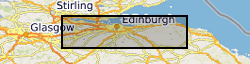
The maps cover grid squares NT05NW, NT06NE, NT06NW, NT06SW, NT07NE, NT07NW, NT07SE, NT07SW, NT08SW, NT17NE, NT17NW, NT17SE and NT17SW. The oil-shale seams covered are Broxburn, Camps, Champfleurie, Dunnet, Fells, Fivestanks, Fraser, Grey, Mungle, New Dunnet, Pumpherston, Raeburn, Under Dunnet, Under Dunnet Barracks and Upper Dunnet.
- Unique resource identifier
- OSGB 1936 / British National Grid (EPSG::27700)
- Distribution format
-
Name Version PDF
- Distributor contact
-
Organisation name Individual name Electronic mail address Role British Geological Survey
Enquiries
Distributor
- OnLine resource
-
Protocol Linkage Name WWW:LINK-1.0-http--link
https://webapps.bgs.ac.uk/data/MapsPortal/ BGS Maps Portal
- Hierarchy level
- Dataset
- Other
-
dataset
Conformance result
- Title
-
INSPIRE Implementing rules laying down technical arrangements for the interoperability and harmonisation of Geology
- Date (Publication)
- 2011
- Explanation
-
See the referenced specification
- Pass
- No
Conformance result
- Title
-
Commission Regulation (EU) No 1089/2010 of 23 November 2010 implementing Directive 2007/2/EC of the European Parliament and of the Council as regards interoperability of spatial data sets and services
- Date (Publication)
- 2010-12-08
- Explanation
-
See http://eur-lex.europa.eu/LexUriServ/LexUriServ.do?uri=OJ:L:2010:323:0011:0102:EN:PDF
- Pass
- No
- Statement
-
The original hard-copy maps were published between 1977 and 1982 by the Institute of Geological Sciences in Edinburgh. The paper maps were scanned to TIF image format at 300 dpi as part a scanning project in 2014. JPEG2000 and PDF derivatives were created from the master TIF scans.
Metadata
- File identifier
- 0226608b-ba6c-0aa2-e054-002128a47908 XML
- Metadata language
- English
- Hierarchy level
- Dataset
- Date stamp
- 2026-07-10
- Metadata standard name
- UK GEMINI
- Metadata standard version
-
2.3
- Metadata author
-
Organisation name Individual name Electronic mail address Role British Geological Survey
Point of contact
- Dataset URI
)))
