 BGS Metadata Catalogue
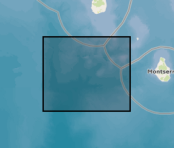
Earthquake Hypocenters on Montserrat from 1995 to 2018 (NERC Grant NE/L002582/1)
Earthquake hypocenters for all earthquakes detected on Montserrat by the Montserrat Volcano Observatory seismic network from July 1995 to February 2018 inclusive. Information includes: Origin Time, Latitude, Longitude, Depth, Hypocenter Errors, RMS and the number of stations used for each location.
Simple
- Date (Creation)
- 2023-07-28
- Citation identifier
- http://data.bgs.ac.uk/id/dataHolding/13608092
- Point of contact
-
Organisation name Individual name Electronic mail address Role University of East Anglia
Jade Eyles
not available
Originator University of East Anglia
Dr J H Johnson
not available
Originator University of East Anglia
Jenni Barclay
not available
Originator Dublin Institute for Advanced Studies
Paddy J. Smith
not available
Originator GNS Science
Victoria L. Miller
not available
Originator British Geological Survey
Enquiries
not available
Distributor British Geological Survey
Enquiries
not available
Point of contact
- Maintenance and update frequency
- notApplicable
-
GEMET - INSPIRE themes, version 1.0
-
BGS Thesaurus of Geosciences
-
-
Seismic epicentre
-
Earthquakes
-
- dataCentre
- Keywords
-
-
NERC_DDC
-
- Access constraints
- Other restrictions
- Other constraints
- licenceOGL
- Use constraints
- Other restrictions
- Other constraints
-
The copyright of materials derived from the British Geological Survey's work is vested in the Natural Environment Research Council [NERC]. No part of this work may be reproduced or transmitted in any form or by any means, or stored in a retrieval system of any nature, without the prior permission of the copyright holder, via the BGS Intellectual Property Rights Manager. Use by customers of information provided by the BGS, is at the customer's own risk. In view of the disparate sources of information at BGS's disposal, including such material donated to BGS, that BGS accepts in good faith as being accurate, the Natural Environment Research Council (NERC) gives no warranty, expressed or implied, as to the quality or accuracy of the information supplied, or to the information's suitability for any use. NERC/BGS accepts no liability whatever in respect of loss, damage, injury or other occurence however caused.
- Other constraints
-
Available under the Open Government Licence subject to the following acknowledgement accompanying the reproduced NERC materials "Contains NERC materials ©NERC [year]"
- Spatial representation type
- Vector
- Language
- English
- Topic category
-
- Geoscientific information
- Geographic identifier
-
MONTSERRAT [id=832700]
British Geological Survey Gazetteer: Geographical hierarchy from Geosaurus 1979 creation
))
- Begin date
- 1995-07-01
- End date
- 2018-02-28
- Unique resource identifier
- WGS 84 (EPSG::4326)
- Distribution format
-
Name Version Comma-separated values (CSV)
witheld
- Distributor contact
-
Organisation name Individual name Electronic mail address Role British Geological Survey
Enquiries
not available
Distributor
- OnLine resource
-
Protocol Linkage Name WWW:DOWNLOAD-1.0-http--download
https://webapps.bgs.ac.uk/services/ngdc/accessions/index.html#item181721 Data
- OnLine resource
-
Protocol Linkage Name WWW:LINK-1.0-http--related
https://doi.org/10.5285/452ca8c1-67f9-4d30-ab38-219987e8efaf Citation Information - Digital Object Identifier (DOI)
- Hierarchy level
- Dataset
- Other
-
dataset
Conformance result
- Title
-
INSPIRE Implementing rules laying down technical arrangements for the interoperability and harmonisation of Geology
- Date (Publication)
- 2011
- Explanation
-
See the referenced specification
- Pass
- No
Conformance result
- Title
-
Commission Regulation (EU) No 1089/2010 of 23 November 2010 implementing Directive 2007/2/EC of the European Parliament and of the Council as regards interoperability of spatial data sets and services
- Date (Publication)
- 2010-12-08
- Explanation
-
See http://eur-lex.europa.eu/LexUriServ/LexUriServ.do?uri=OJ:L:2010:323:0011:0102:EN:PDF
- Pass
- No
- Statement
-
Earthquakes were located using NonLinLoc with the Rowe et al., 2004 1D seismic velocity model. The EDT method in NonLinLoc was used with equal weighting to all stations.
Metadata
- File identifier
- 01db232d-e4bf-411b-e063-0937940a8f07 XML
- Metadata language
- English
- Hierarchy level
- Dataset
- Date stamp
- 2026-07-11
- Metadata standard name
- UK GEMINI
- Metadata standard version
-
2.3
- Metadata author
-
Organisation name Individual name Electronic mail address Role British Geological Survey
Point of contact
- Dataset URI
)))
